
You may create feature layers, give them a geometry type, and set their coordinate systems using the Create Feature Layers dialog. The Create Feature Layer command will create an associated PRJ file if the user selects a Coordinate System while creating the layer.
To create a feature layer, click the Create Feature Layers ![]() command on the Feature Edit Tab to open the Create Feature Layer dialog (shown below).
command on the Feature Edit Tab to open the Create Feature Layer dialog (shown below).
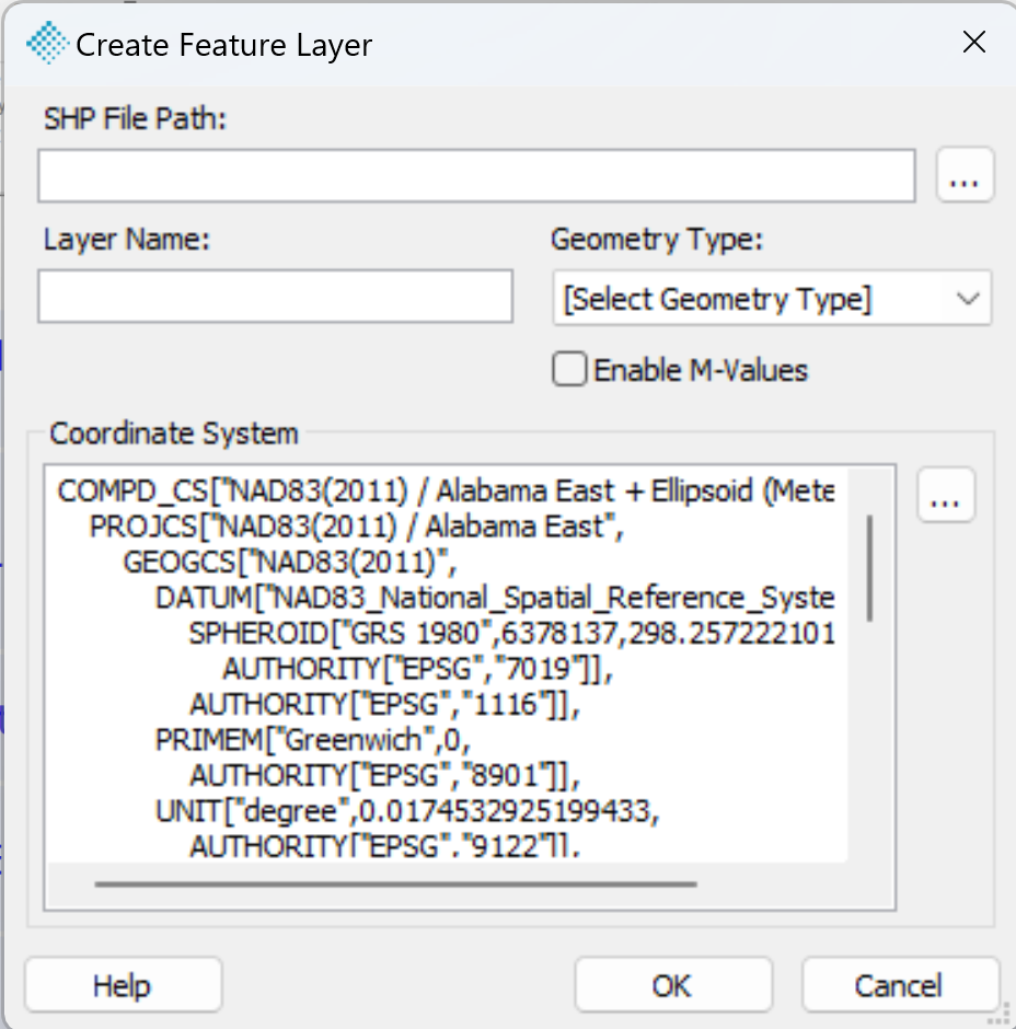
SHP File Path - Enter the path of the shape file here. Press the [...] button to open the Save As dialog.
Layer Name - Enter a name for the layer.
Geometry Type - Choose the geometry type for the layer here. Options include 2D point, 2D line, 2D polygon, 3D point, 3D line, and 3D polygon.
Coordinate System - Use the [...] button to select the feature layer's coordinate system. The default is the Project Coordinate System.
Enable M-Values - Checking this checkbox will result in the creation of an M-Value supported SHP file. A new 'M' column will be added to the Features tab for points and on the Vertex tab for polylines and polygons in the Feature Analyst dialog.