
*The feature is available in the Standard license level and above for LP360.
Classifying LAS points by features is a useful way of assigning classifications to points within a spatial relationship to other features. You can use any vector layer in the map to classify points that are within distances of linear or point features, or completely within polygonal features. Classifying points by features is useful for producing buffers around breaklines, excluding points from within hydrologic features (e.g., ponds, lakes, etc.), and/or classifying LIDAR points based on existing basemap layers such as buildings, roads, etc.
Command Requirements
|
Use the Add Files command to open the LAS files that contain the data you want to use.
On the Point Cloud Task tab, select Type from the Filter By drop-down menu. Then select Classify By Feature from the Filter drop-down menu.
Specify the settings for the Classify operation in the Properties page that displays.
If you selected Input Geometry as the input method, use one of the Geometry tools to specify the points in the map. If you selected File or Shp Layer, click Apply.
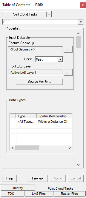
Feature Geometry Layer - Here is where you will set the tool geometry, SHP layer, or other file to use for classifying by features.
Units - The units setting is used to convert your unit preference to the current Map units. This allows you to predefine a standard set of parameters without needing separate settings for different Map units.
Input LAS Layer - The LAS Layer to be used for the classifying by features.
Source Points - The set of points that will be used in the filter. If a classification is not turned on or is a part of the filter, then those points will not be used in the filter nor will they be classified or edited.
Data Types - Here is where you will set the settings for the output (Type, Spatial Relationship, Distance, and Classification).