
Layer Coordinate System
You have full control over the coordinate system that is assigned to the
LIDAR Layer. Assigning a coordinate system
to a layer may be useful for projection-on-the-fly within ArcMap™ or simply
to document the coordinate system for a set of LAS
files.
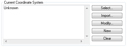
Picture of the Coordinate System Tab
Learn
how to select a Coordinate System
Learn
how to modify a Coordinate System
Learn
how to create a Coordinate System
Learn
how to clear or reset a Coordinate System