
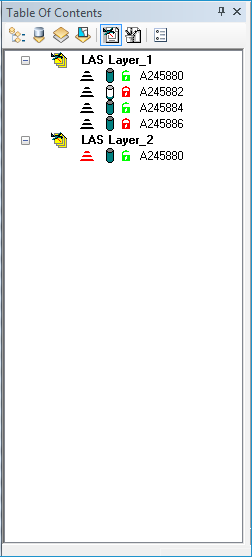
The LAS Files Contents View displays each LIDAR Layer that is currently within the active map or data frame in ArcMap™. Each LIDAR Layer is listed with the LIDAR Layer icon  in the list. The list of LAS Files for each layer can be expanded or collapsed by clicking the plus
  and minus
  icons respectively. The LAS Files Contents View exposes a set of tools to you for managing the LAS files associated with a LIDAR Layer. The following are some of the capabilities of the LAS Files Contents View:
The icons used in the window have the following meanings regarding each LAS file:
|
 |
 Invalid or Not Found
 Not Pyramided
 Pyramided
 Not Loaded
 Loaded
 Open for Read Only
 Open for Read/Write