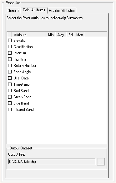
About Summarizing Individual Point Attributes
All
attributes of the point cloud
can be summarized using basic descriptive statistics such as minimum,
maximum, mean, and standard deviation. The field codes used for each
descriptive statistic is 'MN', 'MX', 'AV',
and 'SD' respectively. The following lists the point attributes that
you can calculate these descriptive statistics for along with their
field codes:
- Elevation: EL
- Classification: CL
- Intensity: IN
- Point Source: PS
- Return Number: RN
- Number of Returns: NR
- Scan Angle: SA
- User Data: UD
- GPS Time (if available): TI
- Red Band (if available): RD
- Green Band (if available): GR
- Blue Band (if available): BL
- Infrared (if available): IR
For example, if you choose to export the min,
max, mean, and standard deviation of the elevations then the field
names would be ELMN, ELMX,
ELAV, ELSD respectively.
If grouping by an attribute such as classifications, the field names
would be for class 2 for example: CL2_ELMN, CL2_ELMX, CL2_ELAV, CL2_ELSD.