About Selecting an Elevation Field
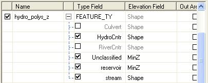
The elevation field determines the source of Z values used when retrieving the features from a breakline source. The elevation field can either be the "Shape" field where the Z coordinate of each vertex is used as the elevation, or from a standard field. If a standard field is used, one elevation (i.e., the attribute value for the feature) is used for the entire feature geometry.Note: If the "Shape" field is not listed for a layer, the layer is not 3D geometry.
Learn more about creating 3D geometry using LIDAR data
The "Shape" field is typically used for breaklines such as stream centerlines where the ability to use Z values for each vertex is paramount. On the other hand, features such as ponds or lakes do not require a detailed resolution of Z values for each vertex and can be described using a single elevation from a field in the database.
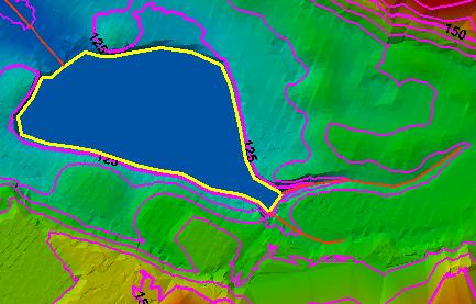
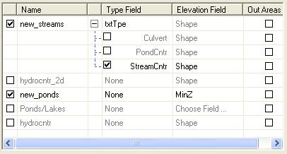
Example of using a "Shape" and standard field
| Streams (red) use the "Shape" field and the pond (yellow) uses a standard field (MinZ) | Selected Elevation fields in the source list |
 |
 |