A portion of the QA/QC process should be to determine what the Coordinate Reference System (CRS) or Spatial Reference System (SRS) is for the LIDAR data. Both horizontal and vertical CRS should be determined as part of the QA/QC process. This check should be done by the vendor prior to delivering the data, as well as the client after receiving the data. This check ensures that the data has the correct information assigned within the header of the LAS files.
This QA/QC step is best run using the statistics extraction since the vertical CRS information is no presented in the Add Files dialog. Computing statistics can be accomplished in two ways: The first is directly within the main program using LP360’s Point Cloud Statistics Extractor Task; The second option is to use LP360’s DOS Command LP360Stats.exe. Both options result in a shapefile that contains the attributes specified in the task or command.
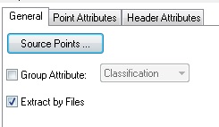
Extract By Files
In order to determine CRS information, the task must be run on a file basis, as opposed to running for an entire project. CRS information is stored in the header of each individual LAS file, thus the information can only be obtained if the program is told to extract the information file by file.
DOS Command Switch for Project versus File:
/s: Use ‘/s’ to define how the summary will be collected by individual LAS file (i) or as a group (a).
GUI Option for Project versus File:
Once the option has been set to extract by file the task can be run against the tiles of interest.
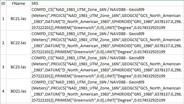
The following is an example of the resulting CRS information for LAS 1.4 files, which was added to the header of the files using LP360’s Export Wizard:
An important note: In order to determine Vertical CRS please make sure the files are not open for read/write, otherwise you will see the warning message, “For Vertical Coordinate System information, run Statistics Extractor with LAS files Read-Only”, written within the CRS field in the resulting statistics shapefile attribute table.


