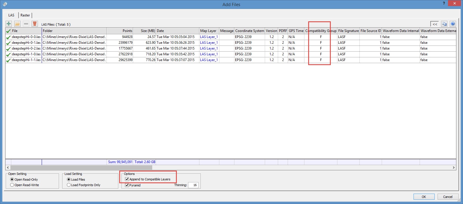
When data is originally added to LP360 the selected files will be grouped into layers, depending upon certain criteria so that only compatible LAS files will be on a single LAS layer.
When adding new data to the layout, if all the data meets the compatible rules, then checking the option to “Append to Compatible Layers” will add the new data to the existing LAS layer.
If the data are not compatible, then it will be necessary to convert the data to the same compatibility group first.
LAS File Version and Point Data Record Format (PDRF)
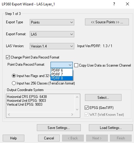
To convert the LAS File Version or Point Data Record Format (PDRF) use the Export Wizard or LDExport. On step one of the Export Wizard, select to export to LAS v1.4 and check the box to “Change Point Data Record Format”. Then select you desired Point Data Record Format (PDRF 6, 7, or 8).
Currently LP360 allows only point data record format (PDRF) conversions to PDRF 6, 7 and 8 of LAS format 1.4. Thus, convert all groups of LAS data to one of these three PDRFs, then re-import all data. The result will now be a single LAS layer in LP360.
Which PDRF should be used?
6 – no Red, Green, Blue (RGB) color attributes (standard LIDAR data)
7 – RGB color attributes (colorized terrestrial LIDAR data, UAS dense image matching data)
8 – RGB + NIR (unusual – used for 4 band cameras)
Note that if one set of data has RGB but the other does not, it is still fine to promote everything to PDRF 7. The data without RGB values will have these fields set to 0,0,0.
Time
If the time storage formats differ then run an Edit on the LAS files using the LAS File Analyst tool to convert your GPS Weeksecond data to Adjusted GPS Standard Time.
- Add the desired LAS files for read/write to LP360.
- Open LAS File Analyst using the button on the main LP360 toolbar or from the right-click menu on the LAS Layer in the Table of Contents (TOC).
- Set the Edit option to enable GPS Time Conversion.
- Select the date of acquisition. Note all the points in the selected LAS Files must have the same date of acquisition.
- Select the desired LAS files to Edit.
- Select Edit in the top right-hand side of LAS File Analyst to execute the Edit.

