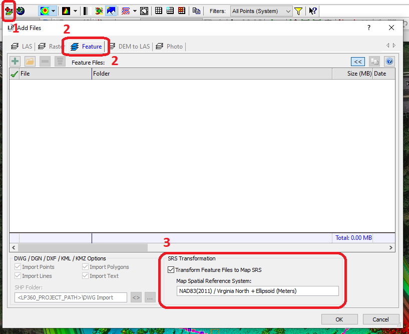
For Reprojecting Vector Features, use the Add Files dialog and go to the Feature tab. There is a checkbox in the lower section of the dialog to Transform Feature Files to Map SRS (Figure 1). The user may need to create a new EVO project with the desired target coordinate reference system (CRS).
Note: EVO does not currently support on-the-fly reprojection or mixing units of measurement. Always have the project and all items in it to be on the same coordinate reference system (CRS).
