When generating a GeoTIFF Ortho using Metashape through LP360, the initial file is written in BigTIFF format which is incompatible with some CAD software packages, including Civil3D. There are also size considerations to be factored in as orthos that are generated in TIFF format are subject to the 32-bit size limit of 4GB. This article reviews how to convert raster file types as well as how to change the ortho generation parameters to create raster files that will be compatible with different third party CAD software packages.
Converting BigTIFF files into TIFF format
To convert BigTIFF files into TIFF format, use the Reproject Raster Point Cloud Task (PCT) to generate a new file that is in TIFF format. Rasters created by LP360 processes can be created in this format. Make sure that the “Create BigTIFF File option” is unchecked when running this PCT.
Size considerations
If the original BigTIFF file is larger than 4GB in size or the user has a specific size limit smaller than the original raster file, the user can generate a grid (using the Grid Generator PCT) to be used to tile the original ortho to smaller size individual files by adjusting the Cell Size value setting. This generated shapefile grid can be specified in the “Feature Geometry” setting of the Reproject Raster PCT.
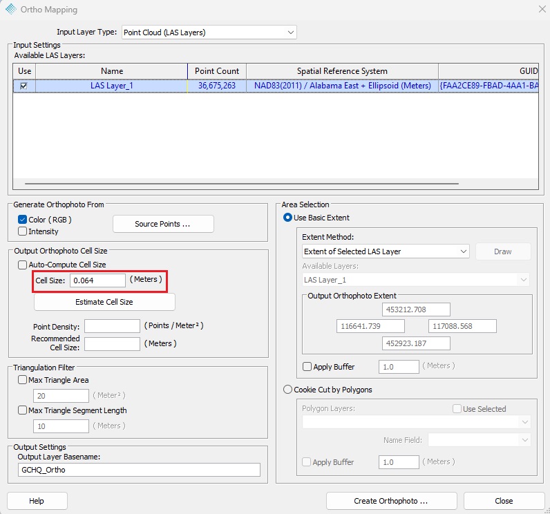
Another potential solution for reducing the raster file size is to increase the Ground Sample Distance (GSD), also known as the cell size or pixel size. Most TrueView generated orthomosaic will have a GSD between 0.06-0.09m which may exceed the resolution needed. This value is automatically determined by Metashape, but you can manually specify the GSD you want. This option is located within the Ortho Mapping dialog seen in the Figure below. Doubling your GSD will reduce the raster data size by approximately 75%. An orthomosaic between 0.12-0.18m is still a very high resolution orthomosaic.


