Classify by Elevation Quartiles
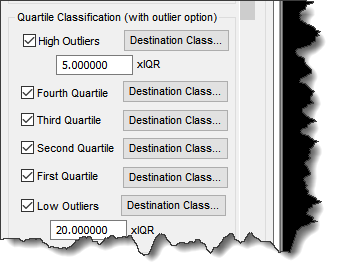
In the Classify by Statistics PCT, the user can set the output of outliers and quartile classification using the standard output class/flag dialog. A little info regarding quartiles: https://byjus.com/maths/quartiles/. The section applicable to Quartile classification is shown in Figure 1:
This classifier works as follows:
- The area to be processed (as determined by however you use the PCT) is divided into a grid of square cells with size equal to the “Cell Size” setting of the dialog.
- A cell is processed by computing an elevation histogram of points (that pass the overall Source Filter for the PCT).
- The points are tagged as to which of the four quartiles they belong.
- If Outlier Classification has been selected for either High or Low Outliers, the Inter-Quartile Range (IQR) is computed. If Outlier classification has not been selected, the points are classified according to the Quartile Classification settings of Figure 1 and the task is complete.
- The High Points threshold is computed as the dividing elevation between Q3 and Q4 plus the user specified multiplier (unit selected by user at the top of the dialog) times the IQR. All points above this level will be set to the user selected High Points Classification/Flags.
- The Low Points threshold is computed as the dividing elevation between Q1 and Q2 minus the user specified multiplier times the IQR. All points below this level will be set to the user selected Low Points Classification/Flags
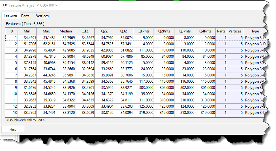
If you choose to create a Shape file of the grid, the metadata of the above algorithm are stored as attributes on the Shape file (below):

