About Toggling the Classification of a Conflation Point Cloud Task
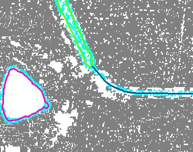
You have the option after conflation of elevation values, to classify LAS points within a distance of the input geometry. This is typically done as a step in the breakline creation process. If you select this option, a classify distance, destination classification, and a determination of how to handle closed lines must be selected.Learn more about buffering points for breakline enforcements
Points are classified using a "Within a Distance of" spatial relationship. Points that are within the specified classify distance are assigned to the selected classification. You may select whether closed lines are treated as polygons or polylines. If you treat closed lines as polygons, all points within the closed line are considered zero distance and satisfies the within a distance of relationship. Thus all points within closed lines when using the option will be assigned to the destination classification.
Learn more about modifying the classify distance
Learn more about selecting the destination classification
Learn more about classifying points within closed lines