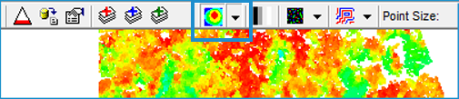
How to Change Legend Type for a LIDAR Layer
Click the arrow next to the Legend Type command on the LP360 toolbar. This will display a box containing all of the available legend types.
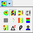
Select a legend type to use for the type of display in the map.


 Display
by User Data
Display
by User DataThe legend type you choose will instantly be applied to the LIDAR Layer displayed.
Tip
|
How to Display No Points
When you want to remove points from display while keeping LIDAR Layers open, simply click the LIDAR Legend command button on the LP360 toolbar to unselect it. Notice that when the command is unselected, it is no longer appears to be pressed on the toolbar.

When you are ready to display points again, click the button again. The previously selected legend type will be used again to display points for the active layer.