The Downstream Constraint method is used to create 3D polylines that are guaranteed to flow in the downhill direction. This method is useful for creating breaklines that hydrologically enforce streams in a downhill direction.
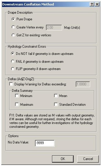
The first step in the conflation method is to perform a drape of the geometry to the LIDAR surface. The drape is performed by the Drape Conflation Method using the user’s selection of the drape description.
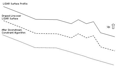
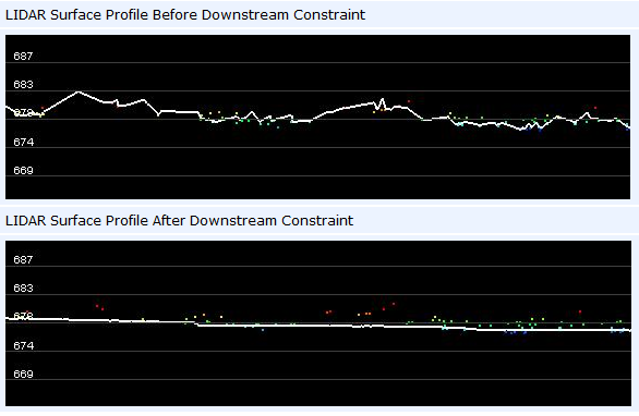
Once the input geometry is draped to the LIDAR surface, a downstream constraint algorithm is invoked on the output geometry to ensure that the vertices will flow downhill. The algorithm using linear interpolation will burn through uphill areas. The following diagram demonstrates how the algorithm works on a simple LIDAR surface profile.
As illustrated in the diagram, flat areas are acceptable to the algorithm and does not attempt to lower or raise the 3D line to create downhill flow.
The downstream constraint algorithm is directionally biased. If the line is drawn in a general downstream direction (i.e., from point is higher than the to point), the z values on the output line will lower the draped values producing a “burning” effect (i.e., cut through the terrain surface that is noisy). The illustration above demonstrates the lowering of the draped values. If the line is drawn in an upstream direction (from point is lower than to point), the z values on the output line are raised from the draped values. The from and to point elevation values will always be guaranteed to be equal to the draped surface values from the LIDAR surface (i.e, not modified by the constraining algorithm).


