Classified Point Clouds: Start Your Infrastructure Projects Instantly
The following article was recently published on the RIB news page, providing the latest news about sustainability and efficiency in engineering and construction. Click Here to read the original article. Special thanks to Tim Scherer, Ingenieurbüro Scherer – bau und engineering for the pictures and data sets.
From Drone to BIM Model
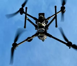
The process for using drone LiDAR has been significantly improved over the past five years. The results of drone surveys are sometimes of such good quality that construction companies or engineering firms can directly start working on infrastructure projects within RIB Civil CAD Software. The classified point clouds that GeoCue can provide today, based on the new TrueView LiDAR technology specified for surveying, reproduce the actual surface of the ground without any noise.
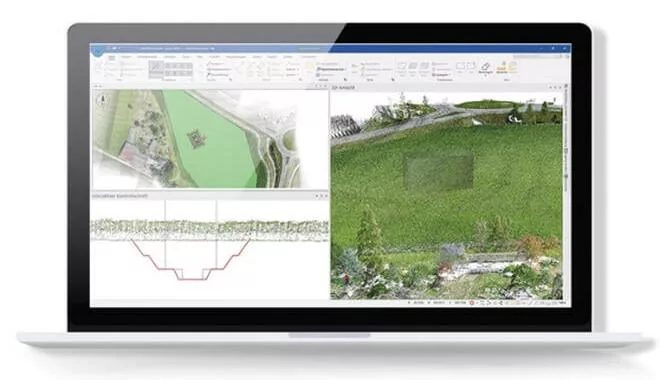
Even in areas with dense vegetation, such as forests or cornfields, where the actual surface needs to be considered. BIM models and quantity calculations can be created immediately without the need to revise the information obtained from the point clouds, as experts from RIB and GeoCue reveal. Labor-intensive post-processing or intermediate steps, such as the additional creation of Digital Terrain Models (DTMs), are no longer strictly necessary. If Digital Terrain Models (DTMs) are needed for specific calculations, they can be obtained from the point cloud in RIB Civil or LP360. The quality of the DTM can be displayed along with the point cloud and documented accordingly. This makes the results of the calculations much easier to understand.

LiDAR Process Becomes Standard in Road and Civil Engineering in Germany
Originally from the automotive sector, LiDAR technology has been adapted and refined for drone surveying, achieving remarkable precision. The scanners were mostly used for distance measurement, which is why the drone’s flight altitude was initially very limited. With the advancement of survey-grade technology, today, drones equipped with GeoCue’s TrueView LiDAR can achieve accuracies within a 6-cm grid at altitudes of 100 to 120 meters. Such advancements have made LiDAR an emerging standard in road and civil engineering throughout Germany, promising similar accuracies even at heights of up to 300 meters under special permissions.
GeoCue’s state-of-the-art systems, now available at half the cost compared to five years ago, integrate LiDAR scanners and cameras for point cloud colorization and orthophotos. These systems are designed for easy integration with a range of surveying drones, offering plug-and-play convenience, and tripling the quality of scans. This leap in quality is revolutionizing how construction companies and engineering offices approach surveying, positioning LiDAR as an indispensable tool in modern surveying technology.

Orthophotos and Classified Point Clouds Together: The Advantages
The collaboration between high-resolution LiDAR scans and orthophotos brings a new dimension to surveying, as Samuel Flick, Sales Manager Europe at GeoCue reveals: “For certain tasks, such as the digitization of captured data, the high-resolution, data-intensive photos are better suited.”
Andreas Dieterle, Product Manager Sales at RIB Software GmbH, emphasize the synergy’s benefits. “In addition, the quality in zoom is always particularly high and can be a great help, for example, in construction accounting,” adds Dieterle. “For billing or creating a cost estimate, the detection of details is inevitable. And different road surfaces, for example, cannot be clearly distinguished from each other within point clouds at high zoom levels without an orthophoto. Digitization is based on the orthophoto, the 3D coordinates come from the point cloud,” he adds.

GeoCue Accuracy Innovation
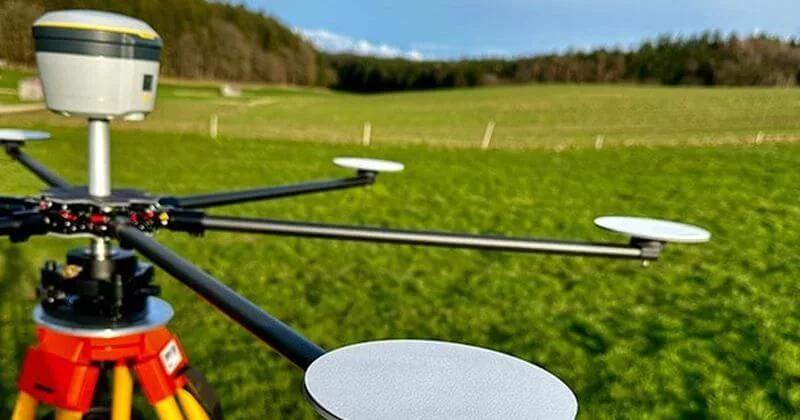
GeoCue is further innovating with accuracy capabilities that automatically detect and interpret control points within point clouds. The “Accuracy Star” product significantly improves fitting accuracy, ensuring precise georeferencing and geometric corrections at the push of a button. This efficiency eliminates the need for additional flights or manual surveys, particularly beneficial in challenging environments or under adverse weather conditions. Thanks to the ring-shaped arrangement on a tripod, georeferencing is implemented even better and a geometric correction of the point cloud can be enabled at the push of a button.
“The combination of the LiDAR process with photogrammetric recordings lays the foundation for value-adding and more sustainable surveying,” states Samuel Flick. “Currently, when skilled workers are often in short supply and time is always tight, this is an invaluable advantage.”
Information can be Transferred 1:1 into the BIM Model
GeoCue’s technology enables the direct transfer of point cloud data into CAD planning software like RIB Civil, significantly accelerating project timelines. This seamless integration proves invaluable for a range of infrastructure projects, ensuring high-quality information is readily available for every step of the process, from BIM planning to construction accounting.
In the coming months, GeoCue and RIB will host several information events to showcase the advantages of their LiDAR technology in conjunction with RIB Civil infrastructure software. For more information on these events and to stay updated on the latest in surveying technology, visit RIB Software’s website: https://www.rib-software.com/de/.