We have now decided to offer LIDAR Server not only as an on-premises solution that users own and operate but also as a subscription model hosted in Amazon Web Services.
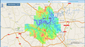
We have just completed a major upgrade to LIDAR Server, our solution for hosting, viewing and delivering LIDAR data. Depicted in Figure 1 is the recent LIDAR data set for Davidson County, Tennessee (Nashville) presented in a zoomed out view of the new JavaScript LIDAR Server client. This is a beautiful Quality Level 2 (QL2) data set provided to us by the USDA (a user of LIDAR Server).
Figure 1: Davidson County, TN in LIDAR Server
We have made a number of significant changes in this update to the system. A few of the significant improvements include:
- Replacement of the Silverlight client with a new JavaScript client, making LIDAR Server available to a wide variety of viewing devices from desktops to iPads
- New base maps, allowing users to select from a wide variety of backdrop context
- A new master index for users who are managing multiple data sets
- Considerable enhancements to the server engine, improving both performance and stability
- Support for project level metadata – users can access project metadata directly from the project index
- Simplification of styles making it much easier to use, configure, and support project deployment
LIDAR Server allows you to manage a large collection of LIDAR data in either an on-premises or hosted deployment. One of the major issues I have seen with customers receiving large LIDAR data sets is that the data set tends to languish on a disk drive, with intentions of providing wide access to the user community but difficulty with the actual realization. With LIDAR Server, you can easily provide rapid access to your stakeholders, significantly increasing their perception of the value of the data collection project. Many users want to view synoptic data but actually only download small areas for intensive study (consider an engineer doing a drainage study for a new shopping center). LIDAR Server provides a facility for users to explore the data set with map and profile views and then to interactively select a download area by simply drawing a polygon around the area of interest. A copy of the data is then cut out and downloaded to the user’s machine in standard LAS format.
We have found that a number of users do not want to deploy and manage their own servers, particularly when the deployed services are open to the general public. To address this concern, we have decided to offer LIDAR Server as a cloud-hosted subscription service. Under this model, users send their LIDAR data to GeoCue and we take care of everything. The data are loaded into an instance of LIDAR Server running in Amazon Web Services and totally managed by GeoCue. This allows you to provide immediate access to your constituents with no effort on your part and no fear of security breaches into your IT systems. We charge a reasonable monthly fee based on the size of the managed data and the anticipated level of traffic.
If you are just now contracting for LIDAR data or have not yet received first deliveries from you LIDAR vendor, you should consider a subscription-based implementation of LIDAR Server as an integral component of the delivery process. Under this GeoCue LIDAR Data Acceptance Model, you can have your LIDAR data shipped directly from the processing contractor to GeoCue. We will perform a first level Quality Acceptance, on a per tile basis, inform you (or your contractor) of any issues that warrant correction and load the data to your hosted LIDAR Server. This takes care of both QA and data hosting. Best of all, the data are incrementally available.
LIDAR Server, whether housed on your internal systems or used as a GeoCue subscription service is the best way to create value for your stakeholders. Just give us a call to discuss deployment options.
