An LPLAS file is a new file type for point cloud data that is compatible with any software able to read LAS. This new file format also follows the ASPRS standards for the most up to date specifications for LAS. Any existing LAS file can be converted to the new LPLAS format by running the LAS data through LP360, which in turn studies the LAS, then optimizes it for LP360. The newly created LPLAS file will retain all the information (classes, color, etc.) of the original LAS file, and simply re-organizes the file structure.
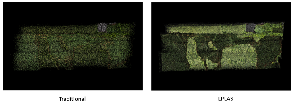
LPLAS files are useful for their improved pyramid performance and highly detailed point cloud display capabilities. An example of this can be seen below.
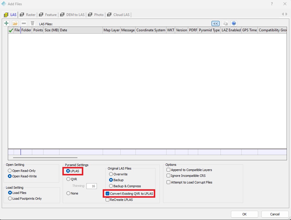
When loading a new LAS file into LP360, you have the option of LPLAS as the Pyramid Settings as well as Convert Existing QVR to LPLAS (seen below outlined in red). Be aware that when you check Convert Existing QVR to LPLAS, the loading time may be increased.
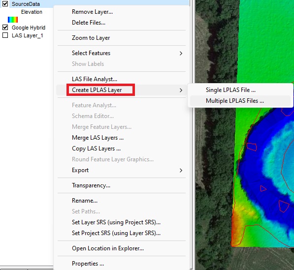
If your LAS has already been loaded using QVR pyramids in your project and you wish to convert to LPLAS, simply right click on the file or LAS Layer you wish to convert and select the Convert to LPLAS, which then gives you two options to choose from. Shown below.
In version 2023.3.18.0 and onwards of LP360, you can also set your default Pyramid Settings in your Project Settings under the EXP tab. Some of the Point Cloud Tasks and tools will output LPLAS files by default, however, not all of them do yet. Be sure to check the file type for newly generated outputs to ensure you have the file type you want in your project. You can check this by right clicking on your newly created file, select LAS Analyst, then scroll to the right until you see Pyramid Type.


