This article is intended as supplemental information from data collection to deliverables from the TrueView Mobile-configured payloads. It lists helpful knowledge base articles that can assist you in every step of your TrueView workflow. Learn about the training options for LP360 and TrueView. Hardware Configuration and Operation Software Configuration and Installation Software Navigation and Processing…
This article is intended as supplemental information from data collection to deliverables from the TrueView Aerial-configured payloads. It lists helpful knowledge base articles that can assist you in every step of your TrueView workflow. Learn about the training options for LP360 and TrueView. Hardware Configuration and Operation Software Configuration and Installation Software Navigation and Processing…
This article is intended as supplemental information from data collection to deliverables from the TrueView GO Handheld unit. It lists helpful knowledge base articles that can assist you in every step of your TrueView workflow. Learn about the training options for LP360 and TrueView. Hardware Configuration and Operation Software Configuration and Installation Software Navigation and…
Ground Classification with LP360 Drone is one of the software’s most common workflows and is required for several other PCTs to function, such as Tree Segmentation, Canopy Height Segmentation, and Building Extractors for dense datasets. For a general video tutorial of the LP360 Ground Classification workflow, please see the How to Perform Ground Classification in…
The Export Wizard provides a flexible way to convert LIDAR data to other formats. Such data includes the export format, extents, tiling of the data, or cookie cutting of the data using polygons. Derived attributes from interpolated elevations such as slope, aspect, and hillshade (brightness) can also be exported to raster files. LIDAR points within LAS files can also be exported to new LAS files. This is useful when isolating…
When using OneDrive for storing your Projects or processing, LP360 will have issues accessing the data files on OneDrive resulting in the software crashing. Probable Resolution Change your Project Root folder to a local folder location on your machine so future projects will not be created in the OneDrive location. Copy the Project Folder for…
This page is no longer updated. Please visit the updated page on the new LP360 Support Knowledge Base for the latest information. When running LP360 Drone (formerly TrueView EVO) and Applanix POSPac some antivirus, firewall, and other defender style software may interfere with processing and cause processing exceptions or slow license check in, or processing…
When working with orthos and other raster layers, it is important to be able to extract an area of interest (AOI) from the overall layer from certain projects. This is possible by using the Reproject Raster PCT. First, you will want to create a new project in LP360 and use the Add Files tool >…
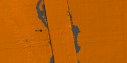
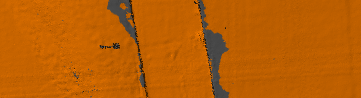
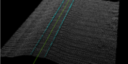
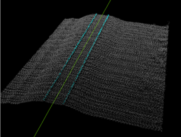
Introduction Three-dimensional point clouds of railways can be used to examine potential hazards along the railway infrastructure, identify track distortions and areas in need of maintenance. LP360 Drone includes tools to automatically extract a rail alignment (centerline) feature as a polyline as well as classify “top of rail” from LAS files derived from Laser Intensity Detection and Ranging…
LP360 Cloud Ground Classification is a processing module on LP360 Cloud. It allows users to automatically classify the ground for data on the cloud. It can be used with any point cloud, however it has been designed for easy use with the TrueView 3DIS sensors. A user must be assigned an LP360 Cloud Starter license…