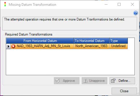
While creating a new layer in a GeoCue project you may see a Missing Datum Transformation dialog appear. The missing datum transformation means that GeoCue does not have a predefined transformation path between the horizontal datum of the layer and the project’s horizontal datum, or the vertical datum’s defined horizontal datum. In most cases that we see it is due to the latter.
Define the datum transformation
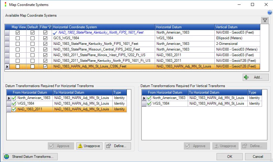
For example, the horizontal coordinate system of the layer has a datum of “NAD _1983_HARN_Adj_MN_St_Louis”, while the horizontal datum for the vertical coordinate system, NAVD88 Geoid 12B, is “North_American_1983”. GeoCue needs to know how to transform the projected coordinates into the geographic coordinate space of the vertical geoid. Anytime the well known text does not match exactly then GeoCue will ask the user to avoid any issues. In this instance, the transformation could be set to “Identity” – meaning treat the two datums as the same and apply no datum transformation between them, or a geocentric transform with no offsets – as the spacing in the geoid is on the order of one minute of latitude and one minute of longitude. This is a fairly large grid spacing and therefore unless the horizontal error of the transformation for the horizontal coordinate is quite large the geoid value returned will be relatively unaffected.
If there is a known path between the datums, but multiple options, say the horizontal coordinate system has a horizontal datum of “WGS_1984” and we are using the same geoid 12B, with a horizontal datum of “North_American_1983”, then GeoCue will select the transform that is most likely to be the correct one. Usually the most current version that is implemented and indicate to the user via an exclamation mark on the layer in the Table Of Contents that it is an unapproved datum. Thus, allowing the user configuring the project to verify and approve the preselected transform or select the desired one. The Map Coordinate Systems dialog can always be used to verify the coordinate systems and datum transformations used in a project.


