LP360 now has a full set of feature analysis and editing tools for working with the geometries of features – points, lines and polygons – in your project[1]. As often happens with LP360 features, the initial driver for adding this capability was a very specific problem; editing the toes of stockpiles being used in volume calculations. The solution, however, is a very powerful set of generalized tools that can be used for a variety of tasks in LP360. One example of this is verifying and analyzing the results of building footprints extracted from your point cloud data.
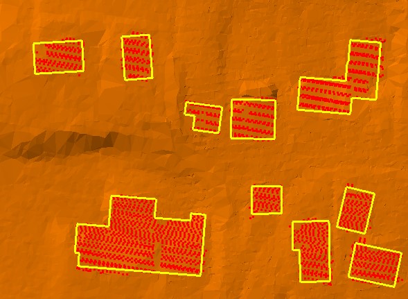
LP360 includes Point Cloud Tasks (PCTs) for performing building classification and extraction from a point cloud. The building classification is done using a planar points filter to search for and reclassify points that fit a defined plane. The user has control over the height range of the features, the minimum search window, Z-threshold, planar fit (goodness of fit), min and max angles, and so forth. The results of running a planar points filter on reasonably dense airborne LIDAR data is essentially an unsupervised building classifier. These planar points are then reclassified as “Buildings,” and a point class tracing algorithm is applied to extract a polygon representing the individual roof planes. See Figure 1 for an example of such classification.

Figure 1 – Planar Points with Group Tracing
The results of such an unsupervised classification are generally quite good for common roof geometries but still need review for QA/QC purposes. This is where Feature Analyst can be very helpful. As an example, we will look at a dataset we recently worked on for the United States Department of Agriculture (USDA). Dickinson County in Michigan was mapped with airborne LIDAR in 2012. This data is roughly equivalent to United States Geological Survey (USGS) QL2 data or approximately 2 points per square meter. The dataset was not initially processed for above ground features or for building classification. USDA wanted to know what the results of an unsupervised building classification on such a data set would look like and if the results were useful for USDA stakeholders in identifying structures of interest to them. Dickinson County is approximately 780 square miles with a population of 26,000. The largest city is the county seat of Iron Mountain (Pop 7,600); it is a rural county.
[1] Feature Analyst is available when running LP360 for Windows. When running LP360 inside ArcGIS, the ArcGIS sketch and edit tools are available for performing similar tasks.
Read complete article: Using LP360 Feature Analyst to QA/QC Building Extraction