
Contour Legend Property Page
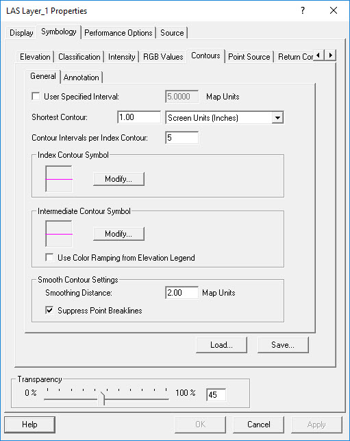
The Contour Legend controls how the contours are displayed on the screen.
Two symbols are used to describe the width and color of the index and
intermediate contour lines. The colors of the intermediate lines can be
assigned using the elevation legend properties yielding a ramp of colors
based on elevation.
By default the system chooses an appropriate contour interval based on
the contents of the current view. The system-chosen contour interval is
designed to allow for fast browsing of the LIDAR
data as the view is panned and zoomed in and out. You may override the
system interval as well as modify the number of intervals between index
contours.
Contour and Annotation Property Pages
Learn
how to modify the shortest contour to display
Learn
how to modify the index and intermediate contour line symbols
Learn
how to modify the contour interval
Learn
how to modify the intervals between index contours
Learn
how to modify the smoothing distance
Learn
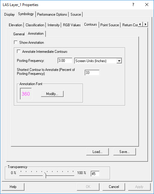
how to toggle annotation visibility
Learn
how to toggle intermediate annotation visibility
Learn
how to modify annotation frequency
Learn
how to modify the shortest contour to annotate
Learn
how to modify the annotation font
Learn how to
modify the transparency