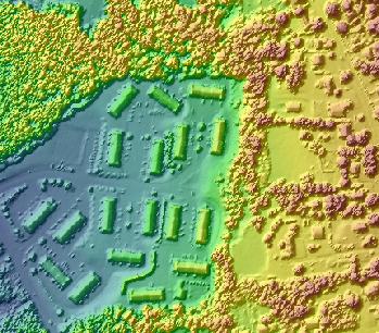
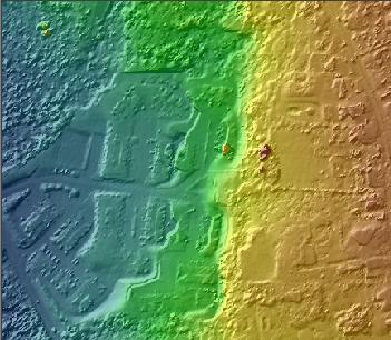

The filter defines what points are exported or are used to construct a surface for exporting. The Filter Property Page is used to modify the filter.
| Shaded Relief Map using All Points |
|
| Shaded Relief Map using Ground Points Only |
|
Learn more about the Filter Property Page
Open the Export Wizard by clicking the Export LIDAR Data command on the LP360 toolbar. The Export Wizard dialog will open with the Step 1 of 3 page displayed.

Define the properties for the export. See How to Complete Step 1: Select the Export Format for instructions.
To define the export filter, click the Source Points button. The Filter Property Page will be displayed.

Use the tabs on the Filter Property Page to define the filter that will determine what points will be exported. See each tabbed page's help topic, listed below, for information on how to define settings on each tab.
Learn about the Classification Filter
Learn about the Return Combination Filter
Learn about the Intensity Filter
Learn about the Elevation Mask
Click OK when you have completed the filter definition.
