The Affine Transform LAS Point Cloud Task is a versatile tool for modifying the coordinates of your point cloud. A common use is applying grid to ground conversions which require more than a simple scale or translation. How to setup the Affine Transform LAS Point Cloud Task to accomplish this may not be readily apparent without reaching back to the matrix math many of us probably left behind years ago.
Setup
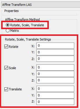
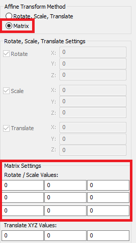
The Affine Transform LAS can be expressed as any combination of a Rotate, Scale, and/or Translate or directly as a matrix. The matrix fields will reflect the input values from rotate, scale, translate and vice versa, so no need to stress over the matrix setup, the program will do it for you from the component parts.
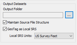
The output from the point cloud task execution will be a new file or file(s) if “Maintain Source File Structure” is checked. With the “Maintain Source File Structure” option the same number of output files will be produced and points will map one-to-one from source file to output file. The “GeoTag as Local SRS” option will add a local Spatial Reference (SRS) tag to the output LAS files indicating they are in a non-standard reference system with units specified by the user.
For more information regarding the math and tips to keep in mind when performing grid to ground conversions, please view our Ground Coordinate Systems and Calculating Grid to Ground Transformation articles. Commonly utilized grid-ground conversions, with included cheat sheets to help the user perform the calculation:
