The United States Geological Survey (USGS) has developed a national 3D elevation program (3DEP) as part of its National Map initiative. The National Map is a collaborative effort among the USGS and other Federal, State, and local partners to improve the publicly available topographic information for the United States. The 3DEP layer of the National Map adds high-quality elevation data that is useful in a wide range of applications and is publicly available for download via the National Map web site. According to the USGS, the goal of 3DEP is to “systematically collect enhanced elevation data in the form of high-quality light detection and ranging (LIDAR) data over the conterminous United States, Hawaii, and the U.S. territories, with data acquired over an 8-year period.” While heavily focused on LIDAR data collection, 3DEP also includes interferometric synthetic aperture radar (IfSAR) data collection for Alaska, where remoteness and weather issues make LIDAR collection much less viable. 3DEP coverage as of April 2017 is shown in Figure 1.
So why should you care about 3DEP? Well it is an excellent – and free – source of high-accuracy elevation data that is easily accessible and already quality-checked for accuracy and conformance to USGS guidelines. If you work in the United States and need elevation data as an input for your mapping applications, you need to be using 3DEP data.
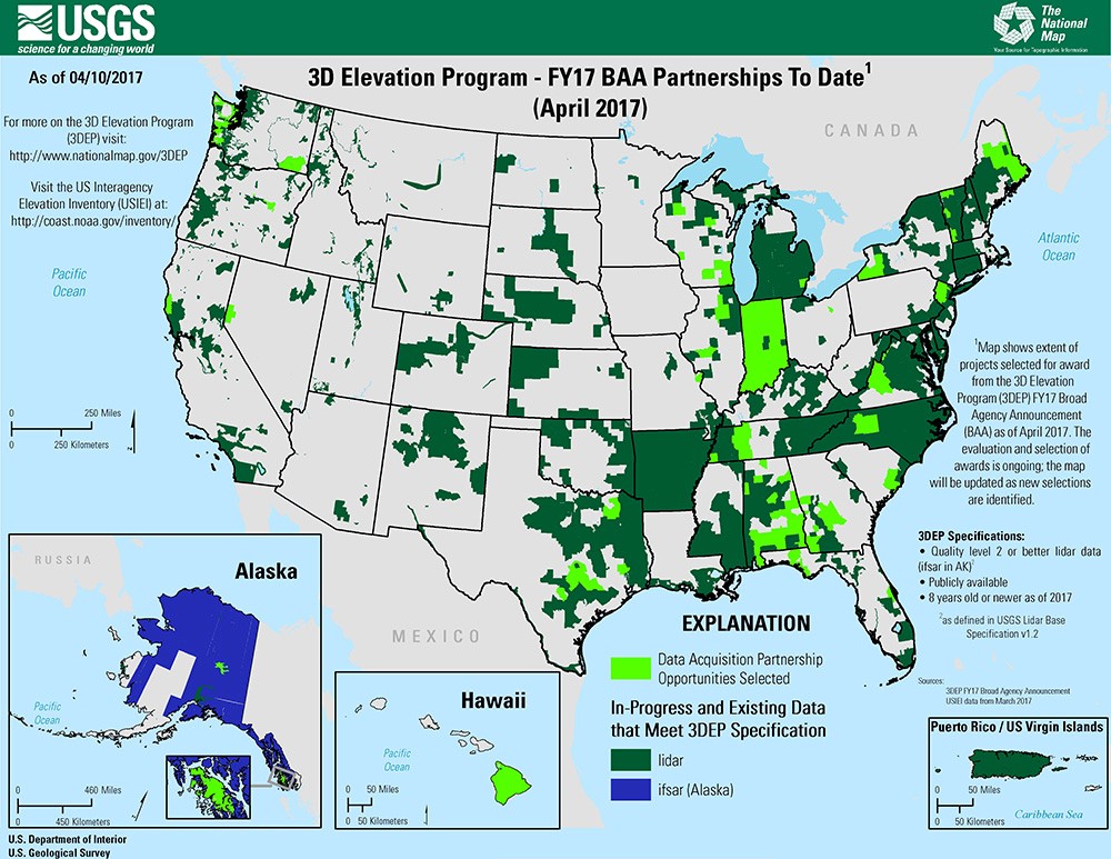
Figure 1 – 3DEP Coverage as of April 2017
There are two main types of data products available from 3DEP; the source point cloud data and derivative products – essentially standard digital elevation models (DEMs) – at various resolutions depending on the available source data.
Read complete article: The USGS 3DEP Program and Why You Should Care
