ASPSuite has the ability to filter out GNSS satellites based on elevation mask, and Signal-to-noise ratio (SNR) mask. Before reprocessing with increased mask settings, it is good practice to check the number of valid satellites used in the solution. The following steps describe the process for checking the number of valid satellites used in the solution.
- After the trajectory has been processed (step 3) open the diagnostics window.
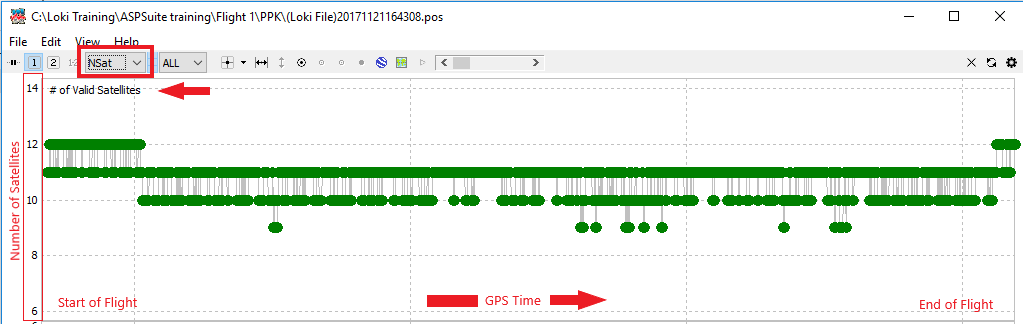
- Select NSAT from the drop-down menu and the number of valid satellites will be displayed at the top of the window.
- The vertical axis represents the number of satellites.
- The horizontal axis represents GPS time.
- The green (or yellow) plots represent the number of valid satellites at a given time during the flight.
Further analysis can be made by opening the obs data:
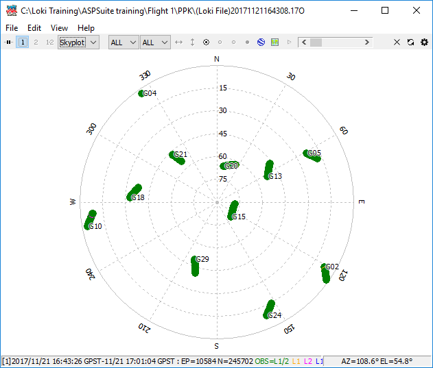
- To do this, click file and “Open Obs Data” or press Ctrl+O. Select the Loki file in Rinex format. The file should have the same name as the sbf file, but with the two digit year and the letter “O” appended to the end of the file (ex. 17O, 18O, 19O, etc.).
- Select Skyplot from the drop down menu and the visible satellites will be displayed. Note that only GPS satellites will be displayed.
- Each ring represent elevation mask angle. If the mask is raised to the specified number, satellites outside of this ring will be removed from the solution.
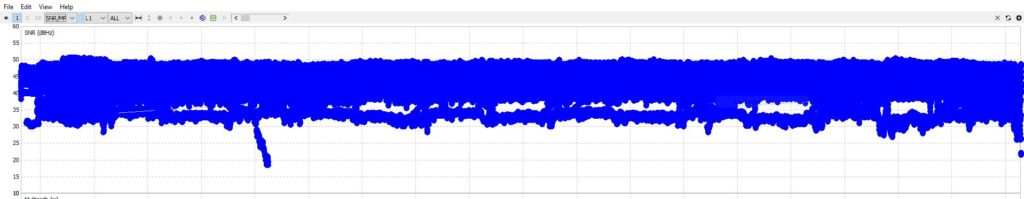
With the OBS data for the Loki rover data opened one can also examine the signal to noise ratio (SNR) for the visible satellites on the SNR/MP/EL plot for the L2 band. Useable satellites are those typically those above 30 or the mask you choose in the processing options if it is higher.