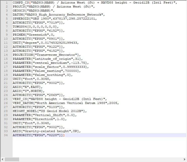
When your data needs to be in a coordinate system that is not specified in LP360, you may need to create a User-Defined Coordinate System. One of the easiest ways to do that is by modifying a Known Coordinate System.

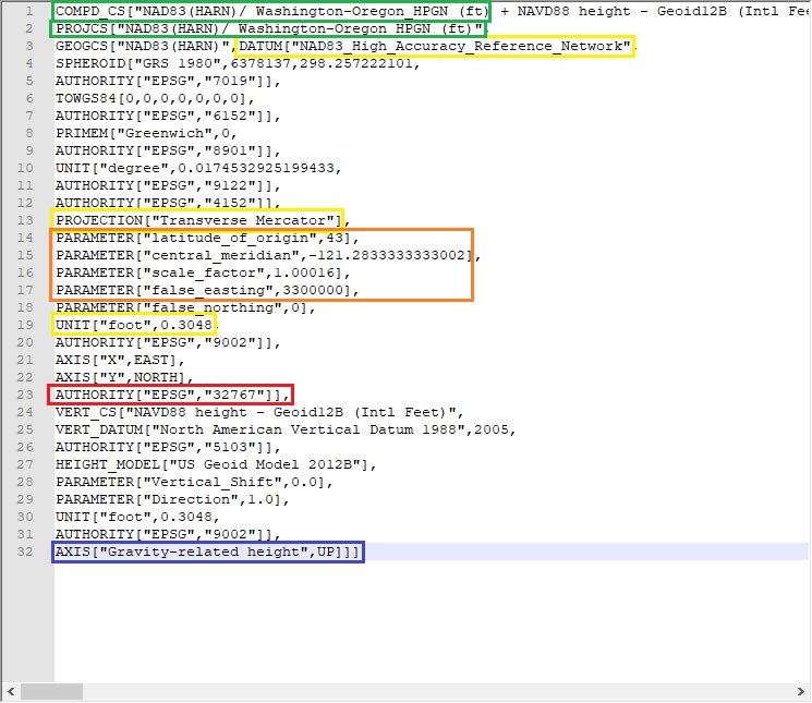
For ease of demonstration I have color coded a User-Defined Coordinate System with what has been changed from a Known Coordinate System. Colors that correspond will be in parenthesis.
- Find a coordinate system that already exists in LP360 with the DATUM, PROJECTION, and UNIT that match what you need for your User-Defined Coordinate System (yellow). These will not be changed.
- Copy the full text of the coordinate system into a text editor. For clarity’s sake it helps to separate the coordinate system by line.
- Adjust the COMPD_CS and PROJCS, to your selected coordinate system name (green) .
- AUTHORITY at the end of the Projected Coordinate System must be 32767, as this denotes it as a User-Defined System (red).
- You would have to change any PARAMETER in a coordinate system if the number from the Known system does not match what you are trying to create (orange).
- At the end of the entire Compound Coordinate System, after AXIS, delete the AUTHORITY line, and close the AXIS line with 3 brackets (blue).
