During the initial setup of a GeoCue LIDAR Processing Project, the user must specify the GPS time storage format for the project. The selected time format is used for all entities and layers within GeoCue. GeoCue will do any kind of conversion on the GPS time values that needs to occur in order for the incoming data to match the time format set for the project.
For example, a LIDAR Project is setup in GeoCue using the Adjusted Standard GPS Time format, which is the recommended option when setting up a GeoCue project. A sensor trajectory is then imported into GeoCue. The sensor trajectory (by definition for the acceptable OUT and SOL formats) is always in the GPS Week Time format, hence, GeoCue will ask upon import what the GPS week (or survey date) is for the data in question. The GPS week can either be entered manually by typing in the blank space, or the drop down calendar can be utilized. The drop down option opens a user friendly calendar where the user can directly pick the survey date. Clicking on the top of the calendar will allow the user to quickly navigate months and years.
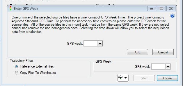
Set GPS week for SBET upon import

Pop-up calendar allows user to specify Day, Month and Year of survey
Once that information has been supplied then GeoCue will store the GPS Week as an attribute to the data. Thus, when TerraScan trajectories are created using the sensor trajectories they will use the GPS Week information stored on the sensor trajectory to determine the correct Adjusted Standard GPS time to assign for each trajectory.
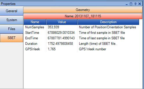
GPS Week Number stored as attribute of Sensor Trajectory
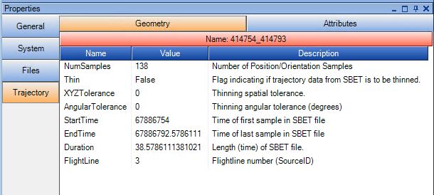
Trajectory in GPS Adjusted TIme
