
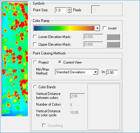
Elevation and Intensity Legend Property Page
The Elevation Legend Property Page
is used to control the symbol size and color of LIDAR
points based on elevation values. The symbol colors based on elevation
values can be calculated using values from all of the LAS
files, current view, or in color bands that simulate contours.
The Intensity Legend Property Page
is used to control the symbol size and color of LIDAR points based on
intensity values. Intensity is a measure of reflected energy in the returns
for a pulse and is similar to a black and white image. High energy or
intensity values result in brighter colors where as low intensity or energy
values result in darker colors.
Picture of the Property Page
Learn
how to modify the point size
Learn
about the symbol preview
Learn
how to select a new color ramp
Learn
how to invert a color ramp
Learn how to use
elevation masks
Learn
how to use the "Project" option
Learn
how to use the "Current View" option
Learn
how to use the "Color Band" option