GeoCue has the ability to import source LIDAR strips with multiple scanners and assign the scanner number to the User Byte in the LAS format. The User Byte is what TerraScan uses for the scanner since no scanner attribute existed before LAS v1.4, and the field, even in LAS v1.4 is limited to a small number of scanners.
File Naming Convention:
GeoCue requires that the LAS files be named according to the following naming conventions and each strip (point source ID) and scanner be in individual LAS files.
Option 1:
“Sensor#Strip#.las”
i.e. Sensor1Strip1.las
Option 2:
“S#C#_#.las”
i.e. S1C1_00001.las
In both cases the scanner gets assigned using the first number from the left, and the strip number the first number from the right. Non numeric characters delimit what constitutes a number.
Import:
To import the LAS files into GeoCue, use the Import LIDAR Data command. Choose “Set from file name” from the “Strip Number Assignment” options, and choose “Multiple” from the Laser Scanners” options.
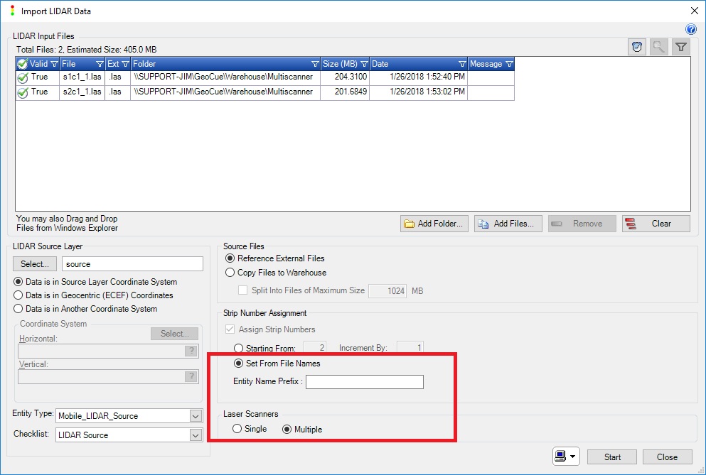
Import LIDAR Data Dialog
After importing, you will see that scanner numbers will be listed in the entity’s properties. If the “Multiple” scanners option was not selected during the import, or the file naming convention was not adhered to, then you will see “Single” in place of the scanner number.
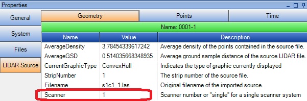
GeoCue Properties Pane- LIDAR Source Entity
