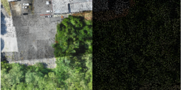
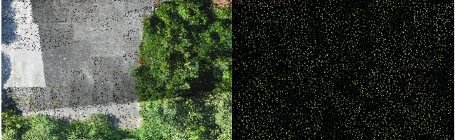
Classify by Statistics is a Point Cloud Task in LP360 that can be created by selecting the “Add Task…” option in the Point Cloud Tasks Manager. It is primarily useful for general data thinning – especially useful for very dense data such as that derived from imagery (dense image matching, DIM, data). For example, you…
I often find myself running point statistics in LP360 (either LP360 for ArcGIS or the standalone LP360) using the stamp Point Cloud Task tools. This allows me to take multiple samples across the project for point density testing or classification counts. I realized that it is not obvious that you can append to a shape…
LIDAR datasets are large and require extensive quality control and quality assurance procedures to ensure desired accuracies and product results. Statistics play an important role in evaluating LIDAR data in an efficient manner during such this QA/QC process. Statistics can be calculated for the LIDAR project dataset as a whole, for each file in the…