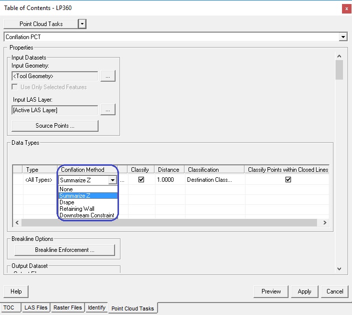
The conflation method defines the algorithm used to assign elevation
values to output features. Currently there are four built-in conflation
methods:
Drape
The Drape method drapes the input geometry over a TIN surface created from LAS points. A z value is stored with each
vertex. A vertex is created for each intersection the input geometry
has with the triangles in the TIN surface. Therefore, the number of
vertices in the output geometry can be much greater than in the incoming
geometry.
Learn
more about the Drape Conflation Method
Downstream Constraint
The Downstream Constraint method first drapes the input geometry over
a TIN surface created from LAS points and then forces the z values
in the output geometry in a downstream direction. This method is useful
for creating breaklines
that hydrologically enforce streams in a downhill direction.
The algorithm used to employ the downstream or upstream constraint
is directionally biased. If the line is drawn in a general downstream
direction (i.e., the 'from' point is higher than the 'to' point),
the z values on the output line will lower the draped values producing
a "burning" effect (i.e., cut through the terrain surface
that is noisy). If the line is drawn in a upstream direction (the
'from' point is lower than the 'to' point), the z values on the output
line are raised from the draped values. The 'from' and 'to' point
elevation values will always be guaranteed to be equal to the draped
surface values from the TIN surface (i.e., not modified by the constraining
algorithm)
Learn
more about the Downstream Constraint Conflation Method
Summarize Z
The Summarize Z method computes z values for entire features or for
each vertex within the input geometry. Z values can be computed as
a mean, minimum, maximum, or specified constant LAS point z value
for a feature or for each vertex of a feature.
Learn
more about the Summarize Z method
Retaining Wall
The Retaining Wall method assigns elevations from the LIDAR surface to a bottom and top of wall
lines. The bottom and top wall lines are stored in the output geometry
as multi-part features where the bottom and top line are parallel
to each other at a very small distance.
Learn
more about the Retaining Wall method
If the None method is selected, then the features
will be excluded from the conflation process. However, if the Classify
Points Within Buffers flag is turned on, points can still
be classified within the buffer of the input geometry.
Learn
more about classifying points within buffers
Learn
more about toggling the use of type values asfd