
*This feature is available in the Standard license level and above for LP360.
The Conflation point cloud task captures the input required to conflate elevation values (computed from LIDAR data) to vector data such as stream centerlines, ponds, lakes, or buildings. The exact algorithm of the conflation (i.e., conflation method) is specified from a set of built-in methods:
Drape: drapes 2D geometry over a TIN surface created from LAS points
Downstream Constraint: drapes 2D geometry over a TIN surface created from LAS points and forces the z values in a downstream direction
Summarize Z: computes z values such as mean, minimum, maximum, or a specified constant for features or vertices
Retaining Wall: creates a bottom of wall line parallel to the input geometry and computes z values for the bottom and top of wall lines
As an optional step in the conflation process, you may classify LAS points within a spatial relationship with the input geometry. For example, if conflating stream centerlines using the downstream constraint, you may also wish to classify a buffer of points around the input stream lines for use in breakline enforcement.
Learn more about breakline enforcements
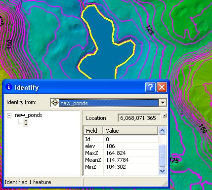
Conflating pond and lake elevations using the Summarize Z method
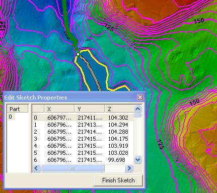
Conflating stream centerlines using downstream constraint
1. Use the Add Files command to open the LAS files that contain the data you want to use.
2. Use the Add Task command to create a new point cloud task. When you are selecting a Task Type in the Add Point Cloud Task dialog, select Conflation. Once you click OK, you should see the unique name that you gave your task selected in the list and the Conflation property page displayed on the Point Cloud Task tab.
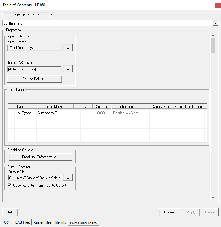
3. Specify the settings for the Conflation operation in the Properties page that displays.
Learn how to select input geometry
Learn how to select the input LAS Layer
Learn how to select a type field
Learn how to toggle the use of type values
Learn how to select a conflation method
Learn how to toggle the classification of buffers
Learn how to modify the buffer distance
Learn how to select a destination classification
Learn more about classifying points within closed lines
Learn how to modify Point Filter
Learn how to use breakline enforcements