When a base station file is corrupt or incorrectly recorded (for example: the observation rate is not set correctly or the battery fails), a user may elect to use the efficient SMARTBase or PP-RTX for post processing the sensor trajectory solution for your TrueView, microdrones, guest sensor Cycles, as applicable. Alternatively, with more effort and time required on a user’s part, a Continuously Operating Reference Station (CORS) may be available to use in its place as your base. To obtain and utilize an available CORS file, follow the instructions below:
- Visit https://www.ngs.noaa.gov/CORS_Map/ and navigate to the area of the flight.
- Want a quick way to find a CORS? Use the Applanix smartBase Cloud utility to locate your project vs the available public CORS data.
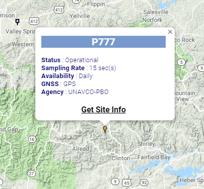
- Once you have found the nearest CORS Station, take note of the Site ID (The 4 characters in the blue box), then click on “Get Site Info”.
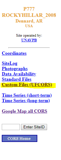
- Once on the site info page, you will see a menu on the left side. Select “Custom Files (UFCORS)”.
- Here is where you will enter all the necessary information of the flight. It is suggested that you give an hour buffer on both sides of the flight time (if you started your flight around 1600 UTC, input the start time as 1500 UTC, and add an extra hour to the duration time). If you want a change in Sampling Rate (Let’s say the CORS recorded every 10 seconds instead of every 1 second), this is where you can fix the problem. This is also where you will enter the Site ID found earlier. Then, select “Coordinate File” under “Optional Files”. Then click “get CORS data file”.
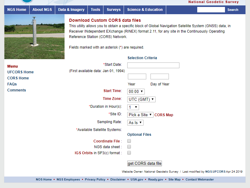
- After it finishes downloading, move the file to the folder where your project is located. In here is where you will find the RINEX observation file (.23O, .RNX, .OBS) that can be used as the base station observation file.
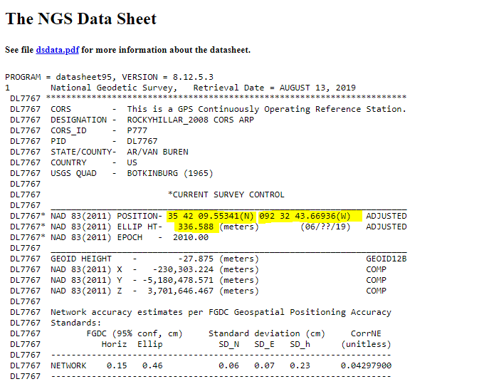
- In LP360, select the downloaded CORS observation file the same way as any other local base station file. You can find the coordinate information in the observation file or on the datasheet to create the Survey Nail/Reference Mark. If the location used is the ARP, then verify the antenna height (HI) is set to zero before processing.