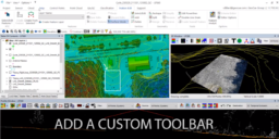
Watch this tutorial video for the Inspired Flight 1200 PLI Mount Installation. Our drone mapping sensors provide a full range of entry to advanced-level systems for collecting photogrammetry and LiDAR data. Watch the video below for a demonstration of the PLI mounting for the IF1200 Th IF1200 is an NDAA compliant heavy-lift UAS platform, made…
Strip Calibration can be used to estimate constant parameters, the boresite angles, but would not be suited to remove inconsistencies in the point cloud generated by dynamic sensor trajectory errors. Please refer to the method and context behind Strip Adjustment and how to use Strip Adjustment for correcting dynamic sensor trajectory errors. Strip calibration should not…
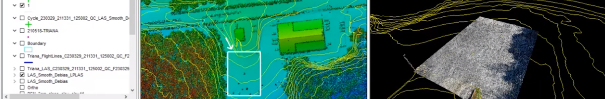
Field operations can be expensive and often have time limitations due to limited access, weather, or even specific temporal ranges specified by a client. For these reasons you should always perform TrueView 3DIS field data checking for production datasets. It is usually more efficient to fly another a survey immediately rather than reschedule. If you…
TrueView systems can be powered from internal battery power or externally powered from drone platforms using the appropriate power connector. Occasionally, there may be an issue where a TrueView system may not be able to be powered from the top power connector on an M300 platform. The TrueView system may power on if the user…
The True View UMS (USB Mass Storage) device should meet the following requirements to be used on the system. TrueView Systems 435vB, 515vB, 535, 545, 655/660, 680, and 720 Note: Once the data has been moved to the UMS, it is no longer stored in the internal storage. Please keep this in mind for your…
A Ground Control Point (GCP) is a monumented point for which geodesic coordinates are known with a controlled accuracy and precision. It can be provided by a National Geodetic Authority or made by the user. Several topographic survey techniques can be used to determine the coordinates of a GCP (GNSS, geodetic network adjustment from distance,…
Attempting to run POSPacCloud to process a sensor trajectory solution in LP360 Drone, formerly TrueView EVO, results in an authentication failed error, “An error occurred running POSPacCloud.exe: C:\Program Files\Applanix\POSPac Cloud\POSPacCloud.exe AUTHENTICATION_FAILED Unexpected character encountered while parsing value:” Please ensure POSPacCloud has installed when you installed LP360. Or manually install using the POSPacCloud setup, POSPacCloud_PROD_v0.0.xx.zip, available under…