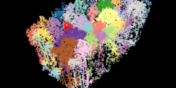
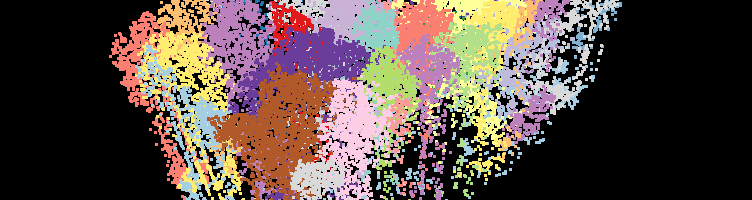
The Tree Segmentation tool can be used on a forested dataset to identify and count the number of trees within an area of interest while also generating two output files: a LAS point cloud to visualize the individual trees and a point feature that contains the height and crown surface area of each tree with…
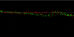
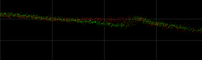
For comparing multiple datasets in a single profile view in the exact same location, all of the Point Source IDs will need to be edited and combined into one LAS layer on import. Before bringing this exercise, import all the desired datasets into a single project, then copy the LAS layers (right-click the layer, selected…
Some scenarios may require you to process your TrueView 3DIS data with different lever arm offsets, IMU mounting angles, or Vehicle to reference angles than the ones recorded in the APX at the time of acquisition. For instance, if you move the system to a new drone, but forget to update the lever arm values…
1. Importando Voos do Sensor Lidar GeoCue para dentro do LP360 DronePortuguese Speaking LP360 workflow video on how to Import Flights from the Lidar Sensor into LP360 Drone 2. Pos-Processando os voos usando o PosPacPortuguese Speaking LP360 workflow video on how to Post Process flights using PosPac 3. Criando Linhas de Voo, Trajetórias e Geocode(Nuvem…
An LPLAS file is a new file type for point cloud data that is compatible with any software able to read LAS. This new file format also follows the ASPRS standards for the most up to date specifications for LAS. Any existing LAS file can be converted to the new LPLAS format by running the…
In LP360 Drone, while attempting to process the sensor trajectory solution for a TrueView 3DIS or microdrones payload in the Cloud run location, the user encounters an error message stating, “Project Status: EXECUTION_FAILED” or “Sensor Trajectory Processing Failed”, where the Project upload was successful, but the project status is “Execution_Failed” and the status type is…
In LP360 Drone, formerly TrueView EVO, the user has a number of options for post-processing the trajectory solution. Applanix SMARTBase is one method that requires no local base station and produces centimeter level accuracy in network. What is SMARTBase? Applanix SMARTBase is a web service that uses existing ephemeris data from public base station infrastructure…
Strip Calibration can be used to estimate constant parameters, the boresite angles, but would not be suited to remove inconsistencies in the point cloud generated by dynamic sensor trajectory errors. Please refer to the method and context behind Strip Adjustment and how to use Strip Adjustment for correcting dynamic sensor trajectory errors. Strip calibration should not…
A Ground Control Point (GCP) is a monumented point for which geodesic coordinates are known with a controlled accuracy and precision. It can be provided by a National Geodetic Authority or made by the user. Several topographic survey techniques can be used to determine the coordinates of a GCP (GNSS, geodetic network adjustment from distance,…