GeoCue Support » Archives for GeoCue Support » Page 4
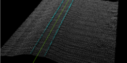
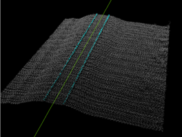
Introduction Three-dimensional point clouds of railways can be used to examine potential hazards along the railway infrastructure, identify track distortions and areas in need of maintenance. LP360 Drone includes tools to automatically extract a rail alignment (centerline) feature as a polyline as well as classify “top of rail” from LAS files derived from Laser Intensity Detection and Ranging…
1. Introduction This article and workflow video are meant to guide new Wingtra LiDAR users on how to process with LP360. The video below will demonstrate the workflow designed for Wingtra LiDAR as well as some recommended tools. We’ve also included a step-by-step guide, after the video, to assist you with your processing. 2. Import…
LP360 Cloud Ground Classification is a processing module on LP360 Cloud. It allows users to automatically classify the ground for data on the cloud. It can be used with any point cloud, however it has been designed for easy use with the TrueView 3DIS sensors. A user must be assigned an LP360 Cloud Starter license…
1. Introduction LP360 Cloud Ground Classification is a module available in LP360 Cloud, starting in 2024, and can be used to automatically classify the ground for data on the cloud. In this article we’ll explain step by step how to use the LP360 Cloud Ground Classification module. Refer to the LP360 Cloud Ground Classification –…
In LP360 Drone, formerly called TrueView EVO, the user has a number of options for post-processing the sensor trajectory solution for a TrueView, microdrones, or guest sensor. Here is a quick comparison chart of the options. For more details on each method click on the name in the header to take you to their descriptive…
Problem: My LP360 license is in use by a process that is no longer active. For instance, my machine shutdown unexpectedly and left my LP360 license locked. How do I recover a floating perpetual license? For subscription licenses, please refer to the How to Recover a Subscription License or LP360 Portal – License Management. Probable…
The Client Portal, or Customer Portal, allows users of the ASPSuite and LP360 (starting at v2018.1) products to manage and monitor their perpetual licenses for both of those products. Users may check the status of their server, review perpetual license usage, and download a report of the perpetual license usage for the day. For subscription…
Attempting to run POSPacCloud to process a sensor trajectory solution in LP360 Drone results in an authentication failed error, “An error occurred running POSPacCloud.exe: C:\Program Files\Applanix\POSPac Cloud\POSPacCloud.exe AUTHENTICATION_FAILED The request was aborted: Could not create SSL/TLS secure channel. When installing LP360 an incorrect version of POSPacCloud was installed separately that was incompatible with the latest…
A brief overview of the installation process when updating LP360 is as follows, details in the Update Guide: The following document covers the upgrade process for the LP360 family of products; LP360 (64-bit), and LPViewer. For new installations, or troubleshooting tips, please see the full Installation Guide.
1. Introduction LP360 Cloud is a new product available in 2023, with support in LP360 starting in the v2023.1 release. In this article, we will describe the product functionalities and how one might use it with your workflows. 2. License LP360 now has two LP360 Cloud Addon products that are subscription licenses: License requirements: 3.…

