LP360 Drone Users Guide
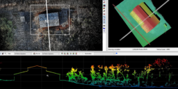
This page is no longer updated. Please visit the updated page on the new LP360 Support Knowledge Base for the latest information. LP360 is a 64-bit Windows® desktop application used for many years by the LP360 Geospatial community for processing traditional aerial, mobile, and terrestrial tripod laser scanner data. The LP360 Drone community is the…

