GeoCue Support » Archives for GeoCue Support » Page 3
When using OneDrive for storing your Projects or processing, LP360 will have issues accessing the data files on OneDrive resulting in the software crashing. Probable Resolution Change your Project Root folder to a local folder location on your machine so future projects will not be created in the OneDrive location. Copy the Project Folder for…
This page is no longer updated. Please visit the updated page on the new LP360 Support Knowledge Base for the latest information. When running LP360 Drone (formerly TrueView EVO) and Applanix POSPac some antivirus, firewall, and other defender style software may interfere with processing and cause processing exceptions or slow license check in, or processing…
When working with orthos and other raster layers, it is important to be able to extract an area of interest (AOI) from the overall layer from certain projects. This is possible by using the Reproject Raster PCT. First, you will want to create a new project in LP360 and use the Add Files tool >…
ASPRS Approves Edition 2, Version 2 of the ASPRS Positional Accuracy Standards for Digital Geospatial Data (2024) Baton Rouge, LA June 28, 2024: The American Society for Photogrammetry and Remote Sensing (ASPRS) is pleased to announce adoption of the Positional Accuracy Standards for Geospatial Data, Edition 2, Version 2 (2024), which includes important modifications and additions…
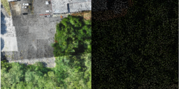
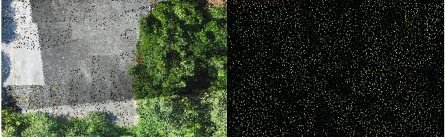
Classify by Statistics is a Point Cloud Task in LP360 that can be created by selecting the “Add Task…” option in the Point Cloud Tasks Manager. It is primarily useful for general data thinning – especially useful for very dense data such as that derived from imagery (dense image matching, DIM, data). For example, you…
Introduction LP360 Drone: At the end of the Post Processing Wizard in LP360 Drone, formerly TrueView EVO, the GNSS information is processed in an attempt to generate a good quality rover position file for use in downstream processing. While processing the GNSS solution a command window displays the quality level (Q level) for each epoch…
1. Introduction This article is meant to guide new LiDAR UAV users on how to process with LP360. This workflow is recommended for any LiDAR UAV user, sensors manufactured for example by Inertial Labs, Greenvalley, Tersus, Yellowscan, Fenix LiDAR or any other LiDAR UAV manufacturer. This workflow is different than TrueView, Microdrones, DJI L1/L2 or…
1. Introduction In this article we will explain step by step how to process a TV540 dataset in LP360 Drone. The idea of the article is to serve as a quick user guide on processing. This article will not explain in detail each of the settings available in each step, that can be found either…
This page is no longer updated. Please visit the updated page on the new LP360 Support Knowledge Base for the latest information. The available LP360 installers for use with the various license levels of LP360 may be downloaded using the links found on this page. The installer for the latest version of LP360 Drone are…
Welcome to our video guide on LiDAR flight planning. In this video, we walk you through the essential steps for planning a successful LiDAR survey mission. From selecting your flight route using DJI Pilot to setting up a custom camera model, we cover everything you need to know. Watch in the video below: Key highlights…