After LIDAR data has been collected and delivered to the processing office one of the first steps, after quality control and calibration, is to run classification routines on the data. There are multiple classification routines, which may be used depending upon the final delivery results of the data, however generally a ground classification routine is…
Ground Classification with LP360 Drone is one of the software’s most common workflows and is required for several other PCTs to function, such as Tree Segmentation, Canopy Height Segmentation, and Building Extractors for dense datasets. For a general video tutorial of the LP360 Ground Classification workflow, please see the How to Perform Ground Classification in…
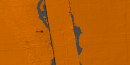
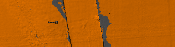
The Export Wizard provides a flexible way to convert LIDAR data to other formats. Such data includes the export format, extents, tiling of the data, or cookie cutting of the data using polygons. Derived attributes from interpolated elevations such as slope, aspect, and hillshade (brightness) can also be exported to raster files. LIDAR points within LAS files can also be exported to new LAS files. This is useful when isolating…
When using OneDrive for storing your Projects or processing, LP360 will have issues accessing the data files on OneDrive resulting in the software crashing. Probable Resolution Change your Project Root folder to a local folder location on your machine so future projects will not be created in the OneDrive location. Copy the Project Folder for…
Classify by Statistics is a Point Cloud Task in LP360 that can be created by selecting the “Add Task…” option in the Point Cloud Tasks Manager. It is primarily useful for general data thinning – especially useful for very dense data such as that derived from imagery (dense image matching, DIM, data). For example, you…
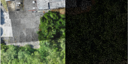
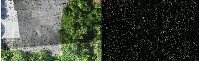
LP360 Cloud Ground Classification is a processing module on LP360 Cloud. It allows users to automatically classify the ground for data on the cloud. It can be used with any point cloud, however it has been designed for easy use with the TrueView 3DIS sensors. A user must be assigned an LP360 Cloud Starter license…
1. Introduction LP360 Cloud Ground Classification is a module available in LP360 Cloud, starting in 2024, and can be used to automatically classify the ground for data on the cloud. In this article we’ll explain step by step how to use the LP360 Cloud Ground Classification module. Refer to the LP360 Cloud Ground Classification –…
1. Introduction LP360 Cloud is a new product available in 2023, with support in LP360 starting in the v2023.1 release. In this article, we will describe the product functionalities and how one might use it with your workflows. 2. License LP360 now has two LP360 Cloud Addon products that are subscription licenses: License requirements: 3.…
The LP360 sUAS license level limits the project size to 4 km². The LP360 EVO, EVO 3DIS, and LP360 Drone license levels limit the project size to 10 km². If LP360 determines the project size exceeds this limitation, this informational dialog, “Your project size now exceeds 4 km², causing sUAS to enter LP360 Viewer mode”…
A recent USGS addendum to the LIDAR Base Specification has stated that “User-defined entities will not be allowed for capturing specific geoid information in the WKT”. LP360 (v2015.1.76.15 through v2023.3.31.1) Note: LP360 v2024.1.30.0 and natively supports the USGS requirements for the VERT_CS. No modifications are necessary in these versions. For older versions, in order to…