Reckon has been deprecated and replaced by LP360 Online, including the LP360 Portal and LP360 Cloud. This page is no longer updated. Please visit the updated page on the new LP360 Portal User Management on the new LP360 Support Knowledge Base for the latest information. In order for someone in your company to be able…
Applies only to PhotoScan/Metashape v2.x. For Metashape v1.x please see this post. To activate a Metashape floating license you will need to have your Agisoft Metashape floating license activation key. To configure Metashape v2.x Floating Licenses on the Server: Configure the Client: Additional Information: You can find installation instructions in the Agisoft Metashape Professional Edition…
User encounters “An error occurred creating the PostProcessTraj.txt file from the SBET. CRS Handler error: [Geown][CRS] LibProj: ‘Invalid value for an argument’” or “An error occurred creating the PostProcessTraj.txt file from the SBET. Error preparing transformer: [Geown][CRS] LibProj: ‘Invalid value for an argument’” when trying to Create TrueView Trajectories after successfully processing the sensor trajectory.…
Save time processing your LiDAR data with Multi-Cycle Import from LP360 When it comes to processing LiDAR and photogrammetric data, GIS professionals have been relying on the 3D High-Performance Point Cloud Processing capabilities of LP360. This advanced LIDAR software makes easy work of extracting information and generating deliverables in an intuitive GIS environment. One of…
One advantage of running Strip Align in the Job Manager in LP360 Drone is the ability to quickly view processing logs for each job. This comes in handy when a job fails and troubleshooting is required. One error that may be displayed in the processing log looks similar to this and denotes an invalid Strip Align (SAfE)…
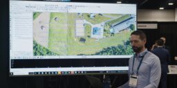
WATCH THIS VIDEO TO SEE HOW TO PERFORM VOLUMETRIC ANALYSIS IN LP360 LP360 has one of the most comprehensive assortments of volumetric tools available for geospatial processing to perform volumetric analysis. Now users can easily define toes and clean volumetric data in a fraction of the time. In the workflow video below, Chad Dillard, the…
This page is no longer updated. Please visit the updated page on the new LP360 Support Knowledge Base for the latest information. Downloading Flight Data The following steps provide instructions for downloading your flight data for Phantom 4 RTK processing in TrueView EVO/LP360 Drone.
Some scenarios may require you to change the default camera exposure settings. For instance, if you are planning to fly with low light conditions. The steps below explain how to change the Camera Exposure settings for the following sensors: mdLiDAR1000UHR, mdLiDAR1000UHR Lite, and mdLiDAR1000LR. Step 1 – Create a file named md_camera.conf that defines the…
My TrueView or microdrones payload collected dark photos on a day with low natural light (early morning, late afternoon or a cloudy day). What can I do to solve the issue? When reviewing the quality of the photos, it is a good practice to check the settings of the camera during the flight. If the…
The TrueView 655/660 Hardware Users Guide covers the ins and outs of installing and operating the survey grade Riegl based True View 3DIS (3D Imaging Systems – LIDAR/Cameras). The TrueView® 655/660 is GeoCue’s fifth generation RIEGL integration built with the miniVUX-3UAV and triple mapping cameras (right, left, nadir) for high accuracy mapping with excellent vegetation…